Overview
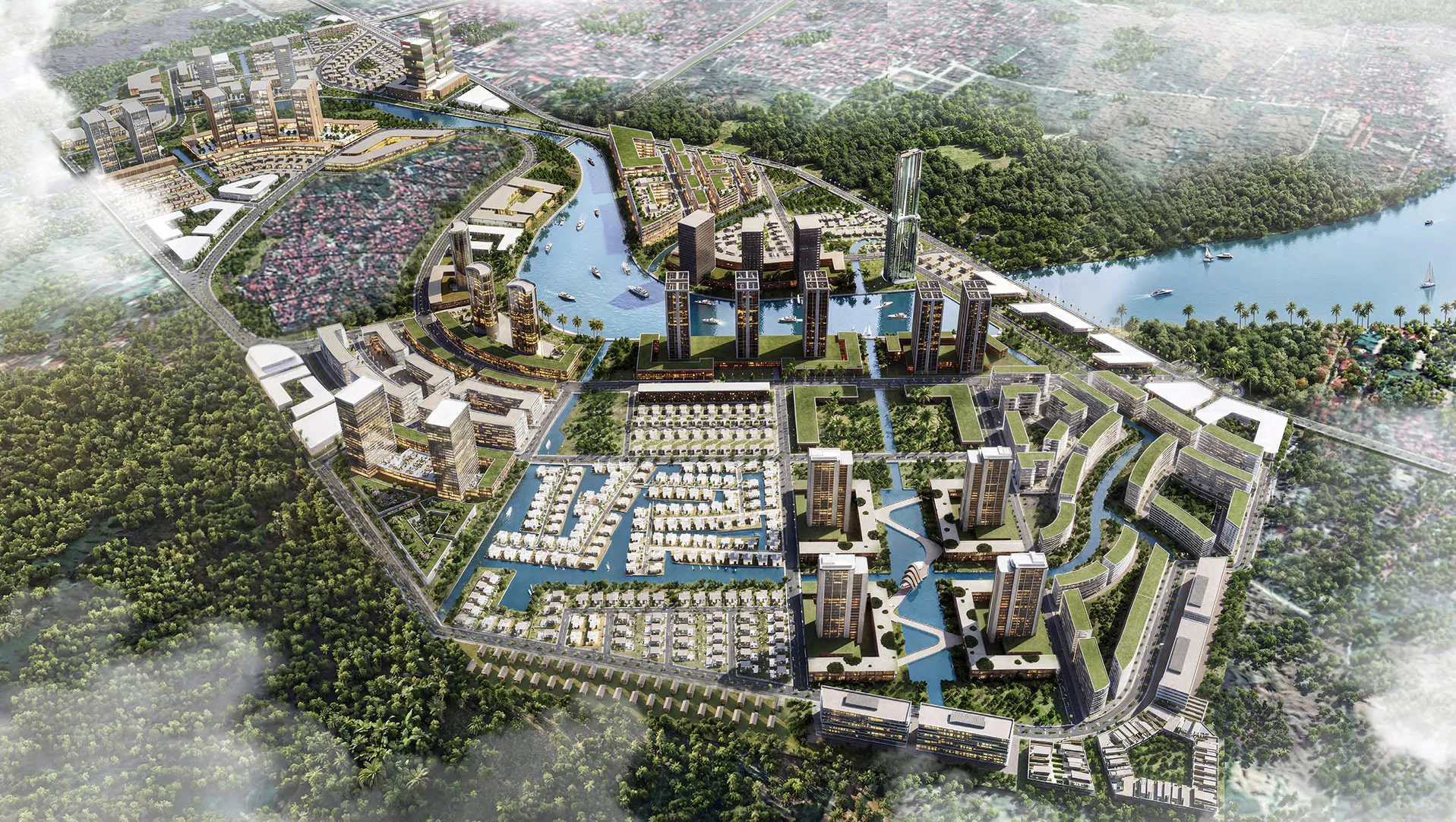
Phung Thuong is an eco-urban masterplan located in Phuc Tho District, approximately 35 kilometres from central Hanoi. Positioned along Highway QL32 at the capital’s western gateway, the project is conceived as a transition between Hanoi’s expanding metropolitan area and the agricultural communities and landscapes beyond the city. The masterplan brings together new and existing residential neighbourhoods, commercial uses, social infrastructure, parks, water bodies and agricultural tourism within an integrated urban framework. Rather than allowing development to erase the site’s rural identity, the proposal builds on its agricultural landscape, waterways and established community to create a distinctive, environmentally responsive district.
© Dewan Architects + Engineers
Project Vision
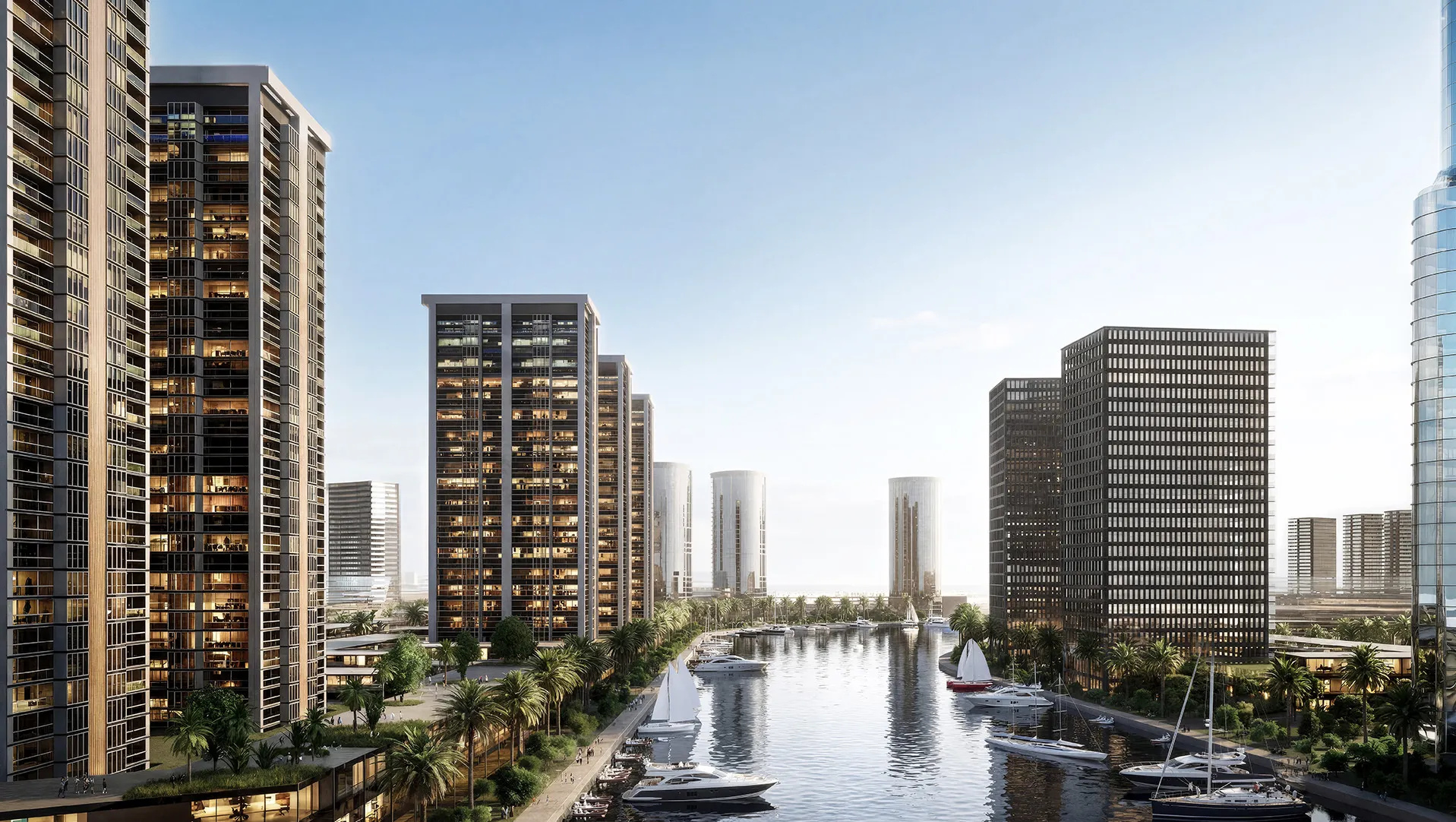
The vision for Phung Thuong was to create a transitional ecological gateway connecting central Hanoi with the agricultural development areas at its periphery. The project combines urban growth with large lakes, natural water systems and productive landscapes, creating living environments closely associated with nature while supporting tourism, cultural activity and local enterprise. Sustainability, walkability and economic opportunity form central parts of the planning approach. Energy use, water management, drainage, health and wellbeing, transportation and improved pedestrian access to parks and open spaces were identified as key priorities for the development.
© Dewan Architects + Engineers
Design Response
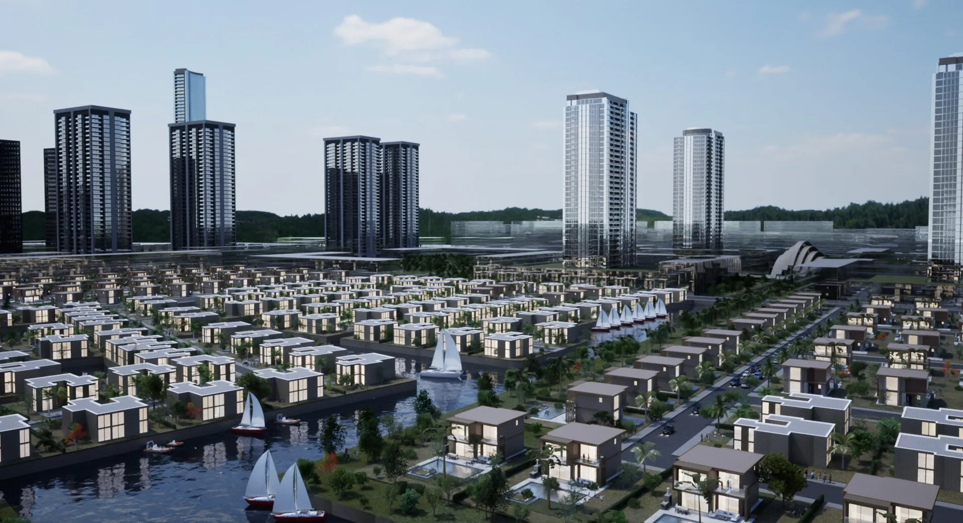
A key challenge was the existing residential community located at the centre of the site, physically dividing the development into two areas. Rather than removing or isolating this community, the masterplan integrates it into the new urban structure and connects both sides of the site through a major central park incorporating green spaces, waterfront activities and recreational routes. Local culture and economic activity are also woven into the plan through a craft village, agricultural research and education, farming experiences and tourism destinations. This creates a framework in which the existing community becomes an active part of the project’s future identity rather than a constraint to development. The masterplan is organised as six complementary character zones: Phuc Tho Community, the Ecological Agriculture District, the Crafts Village, the Marina District, Island Villas and the Eco-Tourism Area. Together, they provide a varied mix of housing, public facilities, commercial destinations, productive landscapes and waterfront recreation.
Key Design Features:
- Central landscape and waterfront park connecting the two sides of the site while integrating the existing community
- Six distinct character zones combining residential neighbourhoods, agriculture, culture, tourism and recreation
- Diverse housing and social infrastructure planned alongside parks, water bodies and productive landscapes
© Dewan Architects + Engineers
Landscape & Public Realm
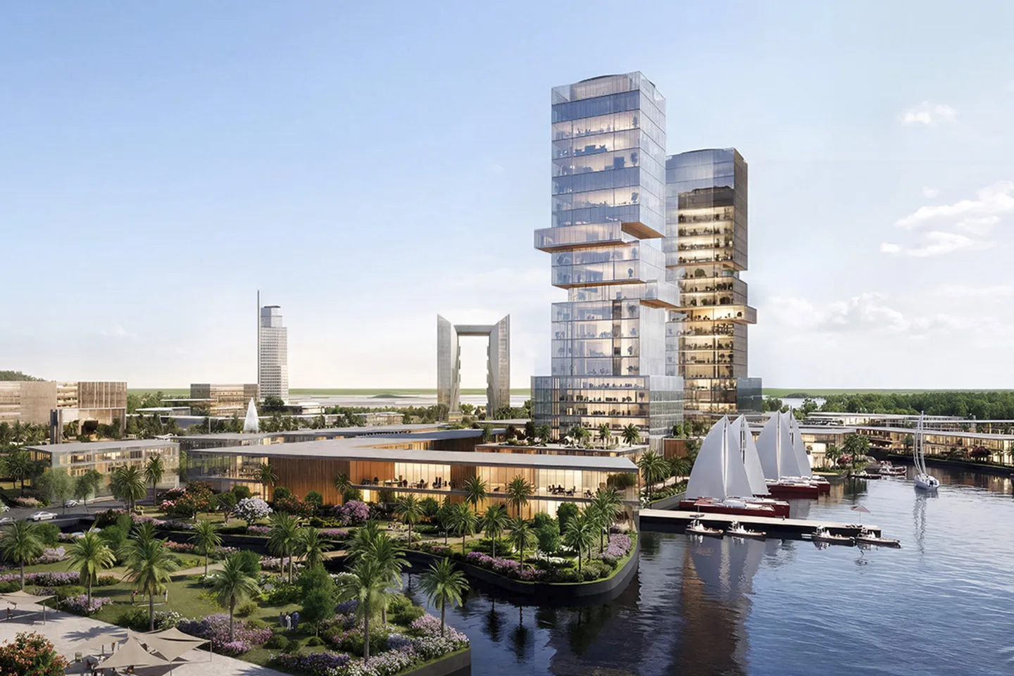
Open space is the defining element of the masterplan, accounting for more than half of the wider study area through a combination of parks, water bodies and public and private landscapes. A connected network of green spaces and waterfront environments links neighbourhoods with community facilities, tourism destinations and recreational amenities. The public realm provides a broad range of experiences, including running paths, waterfront parks, canal walks, gardens, picnic areas, agricultural landscapes and water-based recreation. Three major destinations—Sunrise Gate, Lotus Island and Prosperity Bay—create identifiable focal points within this wider landscape system. Agriculture remains an active component of the development through farm tourism, farming education, sustainable and vertical agriculture, craft production and village-based cultural activity. This approach retains a connection to Phuc Tho’s existing identity while creating new recreational and economic opportunities.
Mobility & Infrastructure
The development is structured by a three-level road hierarchy comprising an arterial boulevard, primary collector roads and secondary collector streets. This framework provides clear access between the project’s neighbourhoods and character zones while connecting the site to Highway QL32 and the wider regional network. Pedestrian movement is supported through walkable neighbourhood catchments, park routes, waterfront paths and connections to surrounding communities. The project’s location also provides access to Son Tay, the Red River, Son Tay Port, Hoa Lac Airport and Hanoi, reinforcing its strategic position at the capital’s western edge. Social facilities are distributed at community, district and sector levels, including schools, healthcare, cultural facilities, a public library, conference centre, museum, stadium and administrative services. This creates a complete urban district capable of supporting both the new population and neighbouring communities.
Performance & Impact
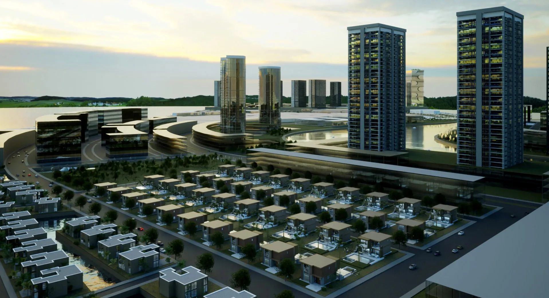
Phung Thuong establishes a long-term framework for urban growth that balances development with ecological preservation, housing provision and local economic opportunity. The masterplan provides capacity for approximately 29,643 homes and a population of around 69,775 people, supported by commercial uses, public facilities and a substantial open-space and water network. Approximately 728,509 m² of the site is allocated to green space and water, while the residential programme includes villas, shophouses, high-rise apartments and social housing. The integration of affordable housing, existing communities and public services supports a more inclusive model of development while providing opportunities for future resettlement and population growth. The project also strengthens the local economy by supporting agricultural tourism, village festivals, craft production and cultural destinations, generating employment and sustainable revenue for surrounding communities.
Performance Highlights:
- Creates a 2,585,815 m² eco-urban district planned for approximately 69,775 residents
- Allocates more than 728,000 m² to green space and water within a connected ecological framework
- Integrates existing communities, social housing, agricultural tourism and public infrastructure within a comprehensive masterplan
© Dewan Architects + Engineers
“Phung Thuong demonstrates how Hanoi’s growth can be accommodated without losing the agricultural landscapes and established communities that give its western districts their identity. By connecting new neighbourhoods through landscape, water and local economic activity, the masterplan creates a resilient urban framework that remains firmly rooted in place.”
Freek Jansen
Branch Manager - Vietnam
Project Facts
The following information outlines the key details of the project.
- Client: Private
- Location: Hanoi, Vietnam
- Size: 2,585,815 m²
- Status: Concept Masterplan Completed
- Scope: Concept Master Planning